It offers a one-year Imagery Analysis certificate and a two-year associate’s degree in Geospatial Intelligence Analysis, according to Minnesota Public Radio News.
In a recent training session, 19-year-old student Emily McGrath used a computer-simulated video to fly over a tiny island off the coast of Spain. As she manipulated a joystick, the landscape unfolded on the screen in front of her.
“I kind of view it as a huge I-spy hunt,” McGrath said. “You could look at this imagery for like hours and hours and still not find everything that you need to. It’s fun, but it’s also nerve racking.”
School spokesman, Jason Trainer, said the school has the first two-year program in the nation offering the certificate and the program.
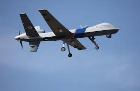
Many of the analysts scrutinizing the images transmitted by drones have received military training.
The program teaches students how to use various computer systems that could prepare them for a military or civilian job. They learn complex geospatial computer programs that require math skills. They also hone writing skills and study privacy laws.


